Mapping

A powerful toolbox for community mapping in spatial engagement. Mapping with Go Vocal provides:

  • Intuitive, rich, location-specific data collection
  • Informed geospatial engagement
  • Efficient input analysis for informed decision-making

We’ve helped Planning and Placemaking practitioners from 500+ governments and organizations worldwide to collect quantitative and qualitative data in spatial engagement projects. 

For community members, it’s an easy-to-use mapping tool that, thanks to rich yet accessible visual depictions of geospatial data, allows them to quickly understand complex data and participate in informed decision-making.
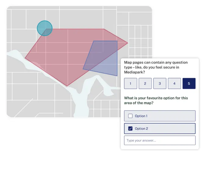
Why planners and placemaking professionals love Go Vocal's
community mapping features

  • Vet your plans or interventions by embedding interactive maps in a survey and having residents answer questions. 
  • Shapefile upload possibility for planners and GIS experts.
  • Diverse input methods to gather the location-based feedback you need. 
  • Dropping pins on a map
  • Drawing polygons 
  • Drawing lines 
  • ESRI integration to visualize data and guarantee informed participation.
  • Unified data format for all contributions, immediately importable in other GIS tools for efficient analysis.

See mapping in action

Experience how our Mapping feature can transform community engagement. Visit Vocal Point, our interactive demo platform, to explore how mapping can help you collect location-based feedback and engage with your community.

Quotation mark

Thanks to the AI assistant, we saved about 10 hours, or 50%, in the analysis phase. These AI-generated summaries were a good base to develop the reports needed to share with the public and stakeholders, enhancing transparency and inclusivity in decision-making processes.

Esther Pickard
Digital and Web Product Manager, Cambridge City Council (UK)

Thousands of your peers…

are using Go Vocal for projects where location-specific contributions are crucial, such as urban development, transport, environmental initiatives, or public space enhancements.

Get inspired by these resources

Blog
Produkt
Sören Fillet
September 5, 2024
Bessere Bürgerbeteiligung in Planung und Stadtentwicklung durch Go Vocals erweiterte Karten-Funktion

Klimawandel, soziale Gerechtigkeit, erschwinglicher Wohnraum und nachhaltige Mobilität stehen ganz oben auf der Liste der Prioritäten. Für Kommunalverwaltungen - aber letztlich bei allen Bürger*innen! Um diese drängenden Themen effektiv anzugehen, braucht es bessere Planungswerkzeuge. Schließlich sollen die Einwohner*innen ja mit in den Entscheidungsprozess einbezogen werden.

Read more
Go Vocal Arrow right
Guide
Künstliche Intelligenz optimal in der Bürgerbeteiligung nutzen

In diesem Leitfaden untersuchen wir das Potenzial von KI als Möglichkeit für Kommunalverwaltungen, die Stimme ihrer Einwohner zu verstärken, und gehen dabei insbesondere auf die Vorteile und Anwendungsfälle für die Beteiligung ein.

Read more
Go Vocal Arrow right
Maximizing efficiency in community engagement with AI

In this webinar, we unveil CitizenLab’s AI toolkit - a set of indispensable tools that will enable you to analyze community feedback more efficiently. Say goodbye to tedious manual work and hello to a quicker path to clear, actionable insights. ‍ Here’s what you'll discover: * Learn how our AI Sensemaking module slashes analysis time by 50%, turning a day's work into mere hours. * See how you can bring offline input to your digital platform with our Form Sync feature. * Hear from our client, the City of Vienna, about how the AI Sensemaking module in our platform will lead to more efficient engagement and better decision-making.

View webinar
Go Vocal Arrow right
Decorative graphic

Ready to see our
platform in action?

Discover how our platform can empower you to collect and analyze informed location-based feedback from your community in spatial engagement projects. Just like it does for 500+ governments and organizations worldwide.

Schedule a demo
Go Vocal Arrow right
Decorative graphicDecorative graphic